
The Evolution of Digital Measuring Tools in Construction
The construction industry has historically relied on manual and analog measurement methods, where a metal tape measure, a level, and a surveyor’s theodolite were constant attributes of any construction site. However, the rapid transition to the Industry 4.0 concept and the total digitalization of construction processes have fundamentally changed the approach to spatial computing. A modern engineer, architect, foreman, or interior designer increasingly uses a mobile phone or tablet not only as a means of communication but also as a full-fledged, high-precision measuring tool.
Today, the global market for mobile spatial measurement applications offers an extremely wide range of technological solutions. This spectrum covers everything from simple on-screen digital rulers for assessing microscopic details to complex hardware-software systems based on augmented reality algorithms and laser scanning. The latter are capable of creating an accurate 3D model of an entire building in a matter of minutes, automatically calculating the areas, volumes, and specifications of the necessary materials. Such evolution has become possible due to the unprecedented miniaturization of sensors, the geometric growth in the computing power of mobile processors, and the rapid development of neural network algorithms for processing visual information.
The introduction of digital “rulers” and mobile spatial scanners solves one of the main problems in modern construction — the gap between the physical world and the digital environment of Building Information Modeling (BIM). Modern digital tools make it possible not just to obtain a discrete numerical value for length or area, but to instantly convert these spatial data into an editable digital format. This forever eliminates the intermediate step of manually recording results in a notepad, which for decades remained the main source of critical human errors when compiling estimates. Moreover, the massive implementation of such tools transforms the very philosophy of construction quality control. From selective spot checks, the industry is moving towards continuous spatial scanning, where every unevenness of a monolithic wall or deviation of a steel beam from the project is recorded in 3D space and automatically compared with design tolerances.
This large-scale study aims to conduct a deep and comprehensive analysis of the modern market for construction measurement applications. Following current security requirements and the support of national products, a special emphasis in the report is placed on prioritizing solutions from Ukrainian developers and companies from friendly countries. Any software of Russian origin is completely and categorically excluded from the review. In addition to a detailed overview of specific commercial products, this report fundamentally examines the technological mechanisms of their operation, the problems of error accumulation, the economic consequences of inaccurate measurements on a global scale, and international standards for integrating measurement results with specialized construction software.
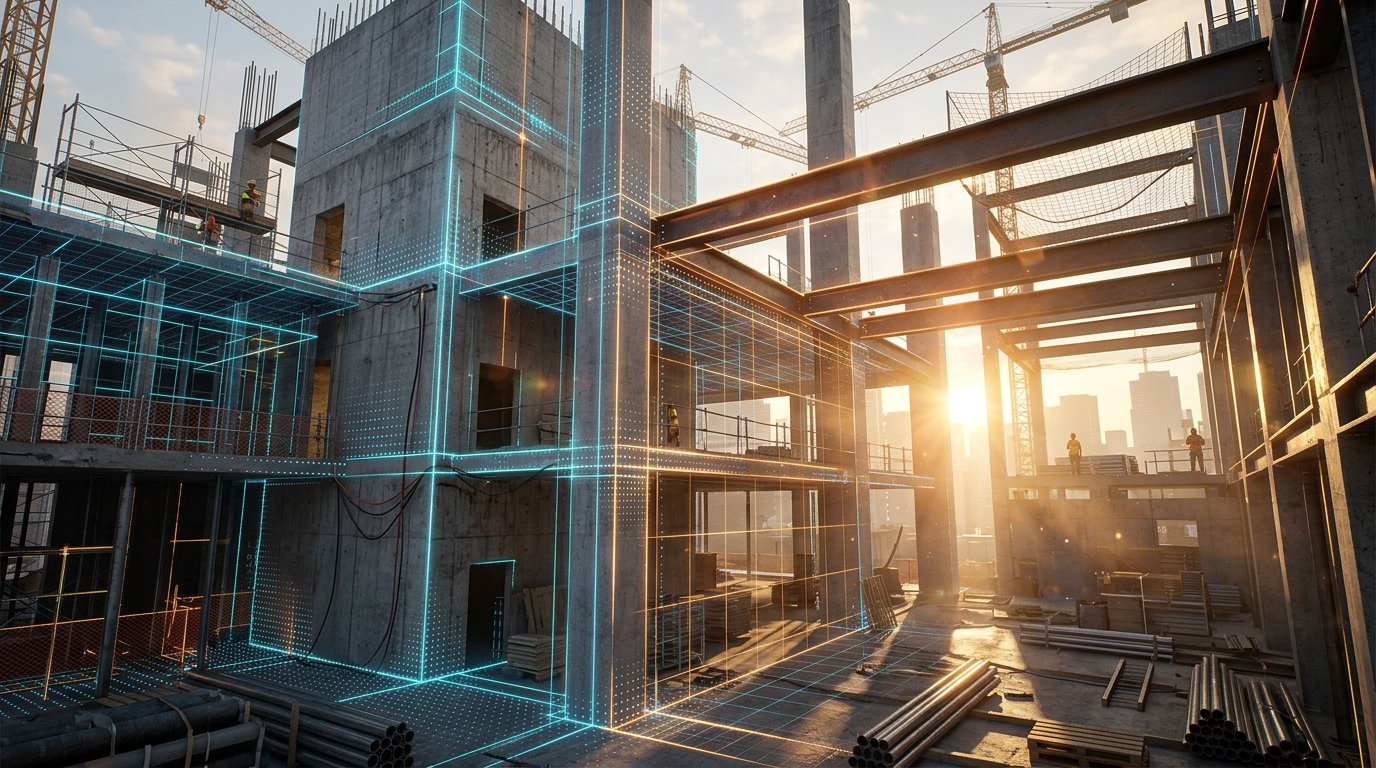
Technological Foundation: From Photogrammetry to Laser Scanning and Inertial Systems
A deep and objective understanding of the capabilities, as well as the critical limitations of mobile measurement apps, is impossible without a thorough analysis of the underlying technologies they are built on. Software apps do not measure space magically; they use a complex synergy of smartphone hardware sensors and heavy mathematical models of spatial orientation that are constantly being optimized.
Most modern apps, positioned by developers as “AR rulers” or “augmented reality tape measures,” are based on the world’s leading simultaneous localization and mapping (SLAM) frameworks. The principle of operation of these optical algorithms is that the camera lens of the mobile device continuously analyzes the surrounding video stream, identifying high-contrast points and features on the physical surfaces of the room. Simultaneously with the visual analysis, the central processor reads high-frequency data from the device’s inertial measurement unit, which necessarily includes an accelerometer and a gyroscope.
By mathematically correlating the displacement of these contrast visual points in each frame with the physical movement of the device itself in space, the algorithm builds an invisible internal coordinate system. Accordingly, when an engineer places an initial virtual point on the smartphone screen, the app rigidly “binds” it to this virtual 3D grid. During further movement of the smartphone along the wall, the program calculates the distance between the fixed starting point and the current camera position in real time.
Although the optical method described above does not require specialized laser equipment and can work on almost any modern smartphone, it has a number of significant limitations that architects and builders should be aware of. Optical plane recognition depends critically on the surface texture and the lighting level at the construction site. If the wall is perfectly plastered in white and has no contrast elements, the algorithm literally has nothing to “catch” on. Under such conditions, measurement becomes impossible, or the linear dimensions are calculated with significant deviations. Similar problems arise when trying to measure glossy surfaces, mirrors, panoramic glass, or when working in darkened rooms. Light reflections on a polished concrete floor can be perceived by the software algorithm as physical moving objects. This causes a specific phenomenon of spatial “drift,” where the established virtual measurement point begins to slide or float uncontrollably over the object’s surface, completely destroying the accuracy of the measurements.
A truly revolutionary step in mobile computing was the introduction of miniature LiDAR scanners into consumer and professional mobile devices. Unlike standard cameras that passively capture reflected light, LiDAR is an active sensor. It generates and emits thousands of infrared light pulses per second, and then measures the exact time it takes for each individual pulse to reflect off an obstacle and return to the receiver. Knowing the constant speed of light, the microprocessor calculates the distance to every microscopic point in space with extreme accuracy, forming a dense 3D point cloud.
Mobile LiDAR successfully solves the lion’s share of problems with passive optical systems. It is capable of working effectively in complete darkness on de-energized sites, instantly recognizes solid smooth walls, and provides incomparably higher accuracy at short and medium distances, which are usually limited to five meters. Field studies convincingly prove that the integration of LiDAR technology with standard spatial positioning algorithms allows for achieving a stable measurement accuracy within one centimeter for objects located at a close distance. Despite this, even active laser technologies face difficulties when scanning perfectly mirrored or coal-black surfaces, as such materials can completely absorb or chaotically reflect infrared rays.
A separate technological class consists of devices and systems that completely abandon the use of optics or infrared lasers, relying entirely on high-precision inertial measurement units of military or aviation grade. By continuously analyzing microscopic changes in acceleration vectors and angular velocities as the device moves through space, these systems mathematically calculate the path traveled, taking into account all terrain irregularities. Such an inertial approach has no alternative for complex measurements over rough terrain, where there are physically no walls to reflect a laser beam, and the satellite navigation signal is blocked by dense forest, high-rise buildings, or a trench layout.
| Technology | Basic Principle of Operation | Key Advantages | Main Limitations for Construction |
| Optical Photogrammetry (SLAM) | Analysis of pixel displacement in the video stream | Works on most standard smartphones | Critically dependent on lighting and textures, high level of spatial drift |
| Mobile LiDAR | Measuring the return time of an infrared pulse | High accuracy, instant scanning, works in the dark | Limited range (up to 5 meters), problems with light reflection and absorption |
| Inertial Measurement Units (IMU) | Integration of accelerometer and gyroscope data | Does not require line of sight, works without lighting and GPS | Requires proper device movement technique, gradual accumulation of mathematical error without reset points |

Leading Ukrainian Developments and Adapted Local Solutions
The Ukrainian IT market in architecture and construction continues to show active development despite external challenges. Domestic engineers and developers from friendly Eastern European countries (particularly Poland) create and maintain software products that not only meet local needs but are also successfully exported, competing with solutions from tech giants. In today’s reality, the fundamental and uncompromising position of the Ukrainian professional community is the total rejection of any software originating from or having servers in the aggressor country. That is why this analytical section focuses exclusively on safe, proven, and reliable applications of domestic and European origin.
A dominant position in the region is occupied by the family of apps from Grymala. Although the company’s legal headquarters is currently based in Warsaw, its development has deep roots in the Ukrainian IT sector, and the products themselves are fully localized and widely used by domestic builders. The flagship products AR Ruler and AR Plan 3D are recognized as some of the most effective tools in the augmented reality segment worldwide. Analyzing the functionality of AR Ruler, its versatility is worth noting. Using only a smartphone camera, an engineer can place reference points in 3D space, instantly receiving linear dimensions in millimeters, centimeters, or meters, depending on the selected standard.
A particular source of pride for the developers of AR Ruler is the comprehensive module for calculating areas and volumes. The user simply needs to outline the contour of the room, moving along the baseboards, after which the system automatically generates accurate values for the floor area and total perimeter. This function is invaluable for quickly estimating materials such as laminate, ceramic tiles, paint, or drywall. Furthermore, a specialized height measurement mode allows finding out the dimensions of doorways or ceilings without using dangerous construction ladders, as the algorithm independently identifies the base floor plane. An important addition to large-scale measurements is the integration of an on-screen micro-ruler, allowing a craftsman to quickly measure the diameter of a drill bit or the thickness of a cable simply by applying the object to the smartphone display. A logical extension of the company’s product line is AR Plan 3D, which automatically converts collected spatial data into professional 2D and 3D floor plans ready for further export.
A striking example of highly specialized domestic software is the BuildMeasure app from RedRobot IT studio. Unlike universal scanners that attempt to cover all possible scenarios, this product was developed in close collaboration with professional installers and contractors specializing in flooring. BuildMeasure is optimized solely for the ultra-fast collection of planar room parameters directly on the cement screed. Built-in algorithms allow installers to instantly convert raw measurements into the exact volume of parquet boards or tiles, automatically taking into account technological gaps, complex cutting specifics, and the standard waste percentage.
Another pole of development philosophy is demonstrated by the Ruler App from Binary Apps. This solution ignores complex 3D calculations in favor of maximum simplicity, stability, and absolute accuracy. The program turns the smartphone display into a classic physical ruler, the scale of which undergoes a high-precision calibration procedure. An innovative multi-touch system allows the user to stretch the measuring sliders directly with their fingers on the screen, achieving sub-millimeter accuracy within the dimensions of the mobile device itself. Such a tool becomes indispensable in situations where a specialist urgently needs to measure a wire cross-section or a thread pitch on a construction fastener, and there is no classic metal caliper in the toolbox.
Although the Construction Estimator App technically does not perform its own spatial scanning, it is an integral part of the local digital measurement ecosystem. This powerful analytical tool is designed to instantly convert measurement results (obtained from other AR rulers) into real construction volumes. The app contains a comprehensive set of engineering calculators to calculate the required amount of bricks, aerated concrete blocks, cubic meters of concrete, rolled metal, and drywall system areas. Armed with such a combination of apps, a foreman can finish measuring a site and, within minutes, send an exact purchase list to a supplier, minimizing material leftovers and avoiding the freezing of the company’s working capital.
| App Name | Primary Purpose | Technological Base | Key Value for the Specialist |
| AR Ruler / AR Plan 3D | Comprehensive architectural measurements and planning | ARCore / ARKit (LiDAR support) | Creating 3D room models on the go, automatic calculation of wall areas and room volumes. |
| BuildMeasure | Organization of flooring installation | Specialized calculation algorithms | Adaptation to the specifics of planar work, accounting for material waste during installation. |
| Ruler App | Precision micro-measurements | On-screen mathematical calibration | Replacement for a caliper to determine the dimensions of fasteners and small parts with high accuracy. |
| Construction Estimator | Generation of accurate material estimates | Analytical construction database | Converting linear dimensions into specific volumes of building mixtures, bricks, and rebar. |
World Leaders in Spatial Computing: Hybrid and Inertial Technologies
Despite the availability of high-quality local products, Ukrainian construction professionals and surveyors are increasingly integrating advanced global innovations into their workflows. Products from global leaders often feature a closed hardware infrastructure, seamless cloud synchronization, and direct integration with complex CAD systems, which allows automating most routine operations.
A British technology company has developed the Moasure device (the latest generations of which are represented by the Moasure ONE and Moasure 2 PRO models), offering a completely unique and radical approach that entirely ignores any optical or laser measurement methods. The core of this technology is a proprietary inertial sensor engine using highly sensitive micro-electromechanical accelerometers and gyroscopes, conceptually similar to those used in aerospace spatial guidance systems.
The workflow with this device differs radically from traditional scanning. The engineer simply takes a small module in hand and, walking along the perimeter of the construction site, periodically applies it to key nodal points. During this movement, the device records and calculates its own displacement in 3D space at tremendous speed. As a result, the system automatically generates a mathematically precise shape of the measured area, taking into account not only the planar parameters of length and width but also complex elevation changes and terrain features.
The main advantage of such an inertial system is absolute independence from physical obstacles. Unlike laser rangefinders, whose operation requires perfect line-of-sight between the device and the target, an operator with a Moasure device can easily bypass an obstacle like a thick tree or construction equipment, and the algorithm will still flawlessly calculate the overall geometry and close the site polygon. According to the developer and independent tests, the linear error of the Moasure 2 PRO is about three-tenths of a percent of the distance traveled. This means that over a base distance of thirty meters, the total deviation will not exceed a few centimeters. Due to its ability to flawlessly record elevations, this device has become an absolute standard for landscape design specialists. It allows them to calculate the exact volume of soil that needs to be removed or added for terracing or leveling a site without conducting complex topographic surveys.
| Measurement Type (Moasure 2 PRO) | Guaranteed Accuracy Level | Maximum Potential Error | Application on the Construction Site |
| Linear Distance | 99.7% | ± 0.3% | Marking trenches, property lines, foundations. |
| Perimeter Measurement | 99.5% | ± 0.5% | Calculating materials for fences, curbs, drainage systems. |
| Elevation Change | 99.7% | ± 0.3% | Checking the slope angle of sewage, storm drains, and ramps. |
| Volumetric Shapes | 98.5% | ± 1.5% | Calculation of cubic meters of soil for removal, concrete volumes. |
The Canadian product Magicplan (from Sensopia) represents the classic school of mobile apps, being one of the oldest and most technologically mature solutions on the global market. Since its inception in 2011, it has evolved from an experimental program to a highly scalable enterprise-grade SaaS platform. The central philosophy of this product is the ability to create comprehensive floor plans, generate financial estimates, and produce detailed technical reports right while the specialist is on-site, without waiting to return to the office. The app masterfully combines the capabilities of artificial intelligence and augmented reality. The user no longer needs to methodically measure each wall separately; simply turning slowly around one’s axis in the center of the room allows the neural network to independently identify corners, door portals, and window openings. The collected data is instantly transformed into professional 2D drawings and 3D models, allowing remodeling contractors to quickly assess the scope of work.
The American product Twindo (formerly known in the market under the Canvas brand by Occipital) occupies a niche of highly professional scanning for architectural and engineering needs. The main goal of this app is to transform “raw,” noisy point clouds obtained from a tablet’s LiDAR sensor into perfectly structured CAD and BIM formats. Instead of placing point markers, the user performs a continuous spatial “painting” process of the room on the tablet screen, collecting tens of millions of infrared reflections. A unique feature of the ecosystem is the commercial Scan-to-CAD service: the collected point cloud is uploaded to the company’s servers, where powerful algorithms, combined with manual checking by engineers, clean the data, straighten curved walls, and return finished drawings in formats fully compatible with industry standards.
Professional Hardware Ecosystems: Integrating Mobile Apps with Laser Rangefinders
Despite the staggering progress in computer vision and mobile LiDAR, classic laser rangefinders continue to hold the status of the undisputed standard for metrological accuracy on professional construction sites. However, modern industrial instruments differ fundamentally from their predecessors; they are no longer isolated measuring tubes. Thanks to the integration of energy-efficient wireless communication modules, these tools are deeply synchronized with specialized mobile apps, forming unbeatable technological ecosystems. The absolute giants and main competitors in this market are the ecosystems of the German concern Bosch and the Swiss company Leica Geosystems.
The German engineering giant Bosch has developed the powerful MeasureOn app, which functions as a universal digital workspace for the entire line of professional rangefinders (the GLM tool series marked with the index “C,” meaning Connected). The implementation of this ecosystem allows for the permanent abandonment of paper drawings and notepads. The workflow is highly ergonomic: a foreman takes a picture of a complex joint or room via the smartphone app. On the resulting photograph, they drag their finger to draw virtual lines along the elements that need measuring. The next step is an actual shot with a physical laser rangefinder. Thanks to a reliable Bluetooth connection, the recorded digital value is instantly transmitted to the smartphone screen and automatically linked to the previously drawn line. For larger-scale tasks, the app provides an infinite digital canvas where architectural plans for entire floors can be designed. Thanks to the SingleKey ID corporate authentication system, all measurements are synchronized via the cloud, allowing a cost estimator in the central office to begin budget calculations the very moment the foreman finishes measuring on a site dozens of kilometers away.
On the other hand, the Swiss brand Leica traditionally dominates the segment of high-precision premium surveying equipment. Rangefinders from the famous DISTO series (specifically models X4, X6, S910) surpass competitors not only by featuring stable wireless connectivity but also by integrating high-quality digital viewfinders with multi-X optical zoom. This is a critical advantage for large-scale outdoor work, as it allows aiming the laser at a target over a hundred meters away even under glaring summer sun, when the red laser dot is physically invisible to the human eye. The flagship Leica DISTO Plan app provides access to the revolutionary Point-to-Point measurement technology. Using high-precision tilt and rotation sensors built into the rangefinder, an engineer can stand at any random point on the site and remotely measure the distance between any two inaccessible objects (for example, between roof edges or high-altitude lintels). The app automatically converts these measurements into spatial coordinates and exports them to engineering graphics formats.
The fundamental line separating entertainment mobile apps from professional measuring systems is mandatory metrological certification. Laser rangefinders from leading manufacturers undergo rigorous independent testing for compliance with the international ISO 16331-1 standard. This standard is the legal guarantee that the device’s manufacturing accuracy (which is often a fantastic 1.5 millimeters) will be maintained not only in sterile laboratory conditions but also in the harsh realities of a construction site. The absence of such standardization for optical AR apps on smartphones makes their measurements legally void in the event of serious financial or architectural disputes.
| Measurement Conditions According to ISO 16331-1 Standard Requirements | Characteristic Testing Features for Certification | Expected Result for a Professional Device |
| Favorable conditions (typical for interior work) | Low level of background lighting (around 3,000 lux), measurements are made on a smooth, matte white wall at a stable room temperature. | Maximum retention of the stated error (e.g., ± 1.5 mm). |
| Unfavorable conditions (typical for exterior construction work) | Extremely bright sunlight (over 30,000 lux), presence of glare, temperature fluctuations, scanning of complex and dark surfaces. | Allowable controlled increase in error according to the manufacturer’s passport tolerances, but without catastrophic deviations. |
The Economics of Errors: The Impact of Measurement Accuracy on Construction Budgets
Discussions about the accuracy of measurement apps and laser tools go far beyond purely engineering disputes; they have direct, measurable, and often catastrophic economic consequences. The construction industry globally is notorious for its extremely poor financial discipline and constant missed deadlines. Macroeconomic reports from the most authoritative consulting firms (including the McKinsey Institute) cite shocking statistics: about eighty-five percent of all construction projects exceed their initially approved budget. At the same time, the average cost overrun across the industry is a massive twenty-eight percent. In practice, this means that a project budgeted at ten million dollars will realistically cost nearly thirteen million.
The foundation of any construction budget is the procedure for calculating the volumes of necessary materials. According to statistical studies, almost a third (about thirty-two percent) of all budget overruns are directly related to fundamental errors at the stage of the initial calculation of volumes and areas. Traditional manual counting, which relies on measurements using outdated physical tape measures and the subsequent manual transfer of dozens of numbers into paper spreadsheets, is inevitably accompanied by the risk of human error. An incorrectly identified digit, an architectural niche missed in calculations, or an uncounted complex roof pitch angle becomes the starting point for a chain reaction of losses.
These seemingly insignificant spatial errors trigger a powerful domino effect that destroys the construction schedule. If a responsible craftsman, relying on an inaccurate free AR app under poor lighting conditions, measured the room area with a deviation of just five percent, the procurement department will order an insufficient amount of expensive tiles. When a shortage of material is discovered on-site, the crew’s work is completely paralyzed. Management has to urgently order an additional small batch, overpaying for expedited delivery. Moreover, a new batch of ceramics or parquet is almost guaranteed to have a different serial tone (shade), which often forces the dismantling of already completed work, multiplying the company’s financial losses.
On the other side of the barricades is the problem of artificial surplus and waste. Knowing well the inaccuracy of manual measurements, foremen almost always include a substantial margin “just in case” in their requests. Because this margin is based on distorted primary data, huge volumes of unused dry mixes, drywall, and metal constantly accumulate on construction sites, which eventually spoil and are disposed of. Construction economics researchers have discovered a harsh and ruthless mathematical correlation: an increase in the volume of construction waste by just one percent leads to a guaranteed increase in total project costs by more than one percent (for example, for brickwork, this coefficient is 1.25). This phenomenon is explained by the fact that the company loses money not only on the cost of the excess material itself but also pays for its supply logistics, the work of loaders, and subsequently—the rental of specialized equipment and high municipal tariffs for the removal and disposal of construction waste.
That is why the massive transition to fully digital volume extraction using integrated mobile scanners and professional estimation apps (such as the cloud platforms Kreo, Metres.ai, or the previously mentioned Construction Estimator) fundamentally changes the industry’s financial landscape. By scanning a real room in a 3D format in a matter of minutes, the software mathematically accurately calculates the total area, automatically and flawlessly subtracting the exact areas of all existing window and door openings—an operation that craftsmen often neglect during quick manual paper calculations. This completely eliminates the psychological factor of fear of making a mistake and allows the construction company to order exactly the amount of expensive materials objectively necessary for the task, radically increasing business margins.
Data Standardization: Export Formats and Deep Integration with the BIM Ecosystem
The real engineering value of any measurement apps and portable scanners is determined not so much by their ability to calculate and display a nice number on a mobile device screen as by their ability to correctly and losslessly transfer this spatial data into a professional design environment. The modern global construction industry is rapidly and irreversibly shifting to the Building Information Modeling (BIM) methodology, where the geometric shape of any object is inextricably linked to a vast array of its physical attributes and operational characteristics.
For basic 2D and simple 3D tasks, collected spatial measurements are traditionally exported into classic engineering graphics formats, such as DXF (Drawing Exchange Format) and DWG. These vector formats have become a universal international language for engineers and architects, understood by all leading computer-aided design systems, including AutoCAD, SketchUp, and their numerous analogues. Professional apps like Leica DISTO Plan or Magicplan are equipped with functionality that allows generating such files directly in the smartphone’s memory right on the construction site. The main advantage of these classic formats lies in their perfect mathematical accuracy; an architect in the office can instantly import the sent file and verify with millimeter precision how much the actually built wall deviates from the perfect right angle set in the design.
However, full-fledged, multi-level integration becomes possible exclusively through the use of the IFC (Industry Foundation Classes) format, supported and developed by the international buildingSMART consortium. This is a completely open format independent of commercial vendors, created specifically for standardized data exchange in building information modeling. When an advanced mobile scanner (e.g., a tablet using LiDAR technology and Apple’s RoomPlan machine recognition platform) processes a physical room, it no longer draws abstract vector lines. The device’s neural networks perform a deep semantic analysis of the space.
Thanks to this analysis, within the IFC format structure, the collected data is transformed into a strict, standardized hierarchy of objects:
- The wall scanned by the mobile device is saved in the database not as a random set of geometric points, but as a specialized entity
IfcWall. This entity automatically receives logical parameters, such as physical thickness, height from the floor, as well as a rigid link to a specific floor of the virtual building (IfcBuildingStorey). - The internal volume of air between the scanned walls is recognized and recorded as a spatial entity
IfcSpace. This is not abstract geometry, but a critical engineering parameter, because it is based on the accurate calculation of the volume of such spaces that engineers further calculate the capacity of ventilation, heating, and air conditioning systems. - Recognized door and window openings are not just empty holes in the plane of the wall; IFC standards define them through complex logical relationships (for example, a subordination relationship where a wall contains an opening, and the opening is filled by a corresponding architectural element).
The continuous evolution of this standard from the older IFC2x3 version to the modern iterations of IFC4 and the newest IFC4.3 has brought revolutionary improvements in the ability to seamlessly transfer complex curved geometry. The implementation of advanced tessellated geometry optimization algorithms makes the transfer of extremely dense point clouds collected by mobile scanners much faster, reducing the load on computing systems. The ability to upload a heavy IFC file from a smartphone directly into secure cloud storage (e.g., via CDE systems) means that a room scanned by an engineer on-site can be opened by experts in Autodesk Revit or Graphisoft Archicad on another continent just minutes after the measurements are actually completed. A BIM expert only needs to check for clashes in specialized tools (like Solibri) and use the resulting accurate geometry as a reliable basis for developing a new design, instead of spending weeks redrawing walls from scratch based on hundreds of scattered photographs and a foreman’s notepad notes.
| Export Format | Primary Application Area | Data Structure | Format Limitations |
| DXF / DWG | 2D drafting, planning, issuing working documentation | Vector lines, layers, basic blocks | Lack of semantics (the program does not understand that two parallel lines are a “wall”) |
| PDF (Scalable) | Coordination with the client, printing documents for workers on site | Raster or vector graphics without the ability to edit in 3D | Static document, not suitable for engineering calculations |
| LAS / GLTF | Presentation of objects, virtual reality, saving point clouds | 3D Mesh or coordinate point set | Focus on visualization, weak support for engineering material attributes |
| IFC (OpenBIM) | Comprehensive information modeling, clash detection, coordination | Semantic database (walls, volumes, doors) with geometric representation | Requires high engineering qualifications and specialized expensive software to work |
Conclusions and Strategic Perspectives for Industry Development
The global digitalization of construction measurements has successfully passed the point of no return. Technological tools that less than a decade ago seemed like attributes of science fiction or required the involvement of stationary surveying equipment costing tens of thousands of dollars are now available as software apps on mass-produced mobile devices.
A deep analysis of the modern market convincingly demonstrates that the choice of measurement tool must strictly and uncompromisingly match the engineering task at hand. Simple optical positioning apps (augmented reality without the use of active LiDAR), such as the basic mobile versions of AR Ruler or Ruler App from leading domestic and Eastern European developers, are ideal for quick express measurements, preliminary visual assessment of structure dimensions, or rapid calculation of painting areas. These solutions have brought about a true democratization of spatial measurements, but their tendency towards exponential error accumulation (drift) and critical dependence on lighting conditions prevent them from being used as a foundation for serious legal or financial construction documents.
To organize professional construction processes, reconstruct historical heritage sites, execute precise landscape design, and create accurate digital twins of buildings (BIM models), specialized hardware solutions are absolutely essential. These include the latest generation of mobile LiDAR scanners, inertial topographic systems (like the British Moasure), or professional laser rangefinders deeply synchronized with smartphones (integrated ecosystems like Bosch MeasureOn or Leica DISTO Plan). Only these high-tech devices, having passed certification under standards such as ISO 16331-1, have proven their ability to consistently provide accuracy ranging from a centimeter to a millimeter. Such accuracy directly meets strict construction tolerances and global quality control standards.
The massive global transition to fully digital methods of measuring spatial scopes of work and material specifications has a powerful potential to radically solve the problem of construction cost overruns. By leveling the destructive human factor in cost estimation and extracting volumes from drawings, companies can save millions of dollars on every major project. The future of the construction industry undeniably lies in the paradigm of seamless digital integration: a situation where a spatial measurement performed on a construction site using a smartphone instantly and without human intervention enriches the building information model in the cloud, automatically updates warehouse material specifications, and generates financial purchase orders. It is this approach that will finally shape a unified, transparent, and maximally efficient construction cycle for the new millennium.
Related articles
TOP-6 companies manufacturing loft-style interior metal stairs
Looking for metal stairs in loft style in Kyiv? Check out the TOP-6 manufacturers: prices, full production cycle, materials, and expert selection tips.
TOP-6 floristry studios in Ukraine: Analysis of architecture, design, and engineering innovations
TOP-6 floral studios in Ukraine: architecture, design, and engineering innovations in flagship spaces of LoraShen, Camellia, DonPion and other brands.
First Article Inspection Quality Control in Metalworking: A Comprehensive Analysis of Processes, Standards, and Economic Efficiency
First Article Inspection (FAI) in machining: ISO & AS9102 standards, CMM testing, non-destructive control, process flow, and cost efficiency.