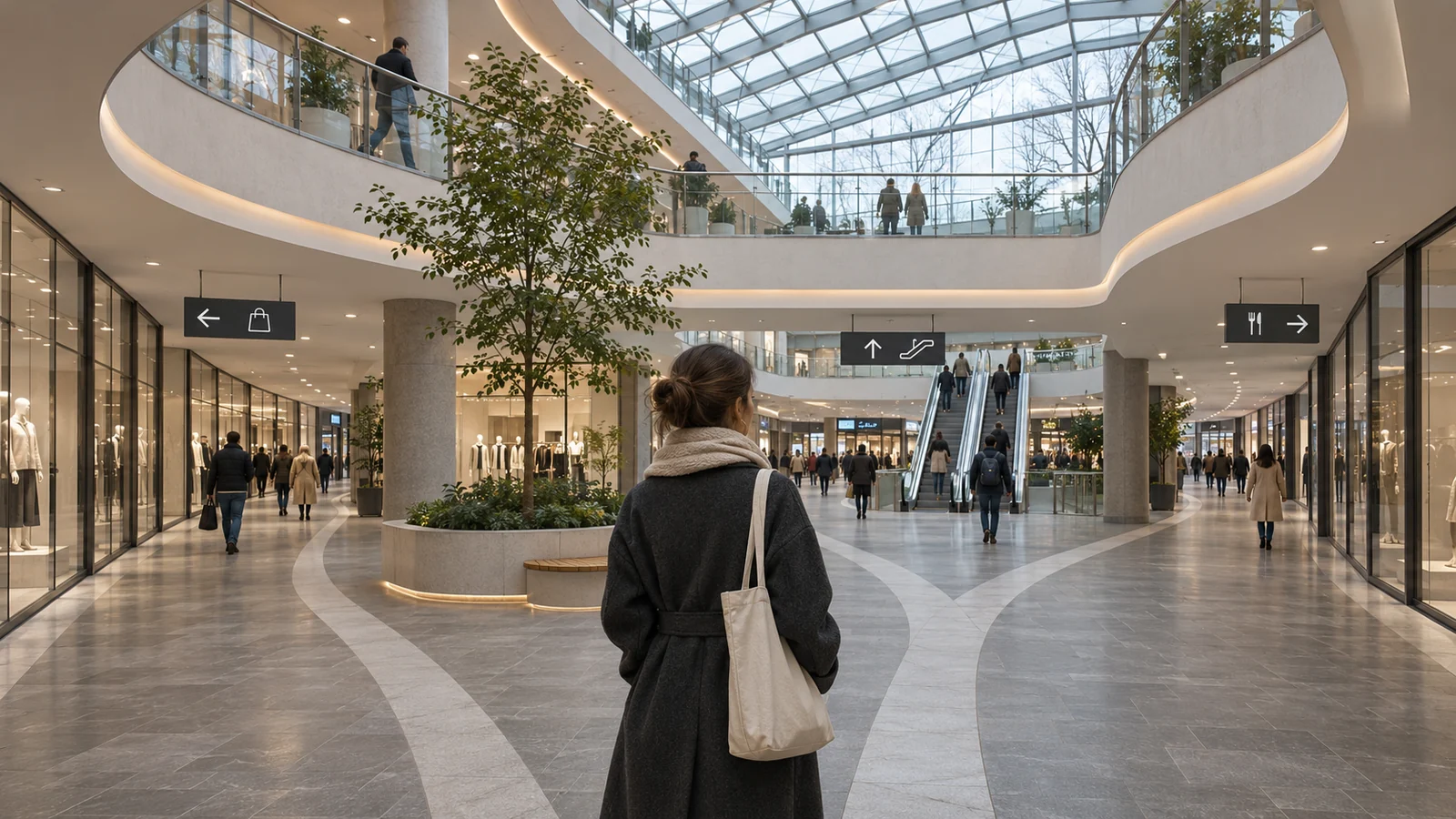
You can see the cinema one level above you. The escalator in front goes down. The lift is somewhere behind the shops, and the “You are here” map shows the building from a direction you are not facing. Seeing where you want to go and knowing how to get there are different tasks.
It is easy to get lost in a mall when the next landmark is out of sight at a decision point or the route to another floor is unclear. Repeated corridors, hidden lifts and inconsistent names make that harder. Good wayfinding starts with a readable route and puts the necessary information where people choose their next step.
How we find our way in an unfamiliar building
Wayfinding is how people determine where they are, choose a route and recognise that they have arrived. A first-time visitor builds a mental map from visible places: the entrance, an atrium, a stair, a shop or a distinctive doorway. Two identical wings and a missing landmark after a floor change give that visitor less information to work with.
Three difficulties can look alike. A visibility problem arises when a shop is in view across an atrium but the route to the upper level is hidden. A spatial problem occurs when you step off an escalator facing the other way and lose your reference point. An information problem occurs when the same level has one name on the website and another on the signs. Diagnose the obstacle before changing the signs. Research on navigation in multi-level buildings
Two layouts and four decision points
Imagine two schematic shopping centres with the same entrance and destination positions. Route A has three open branches along the main path. Route B has one. In this exercise a decision point is where another direction is available. A bend with no alternative is part of the route without adding a decision.
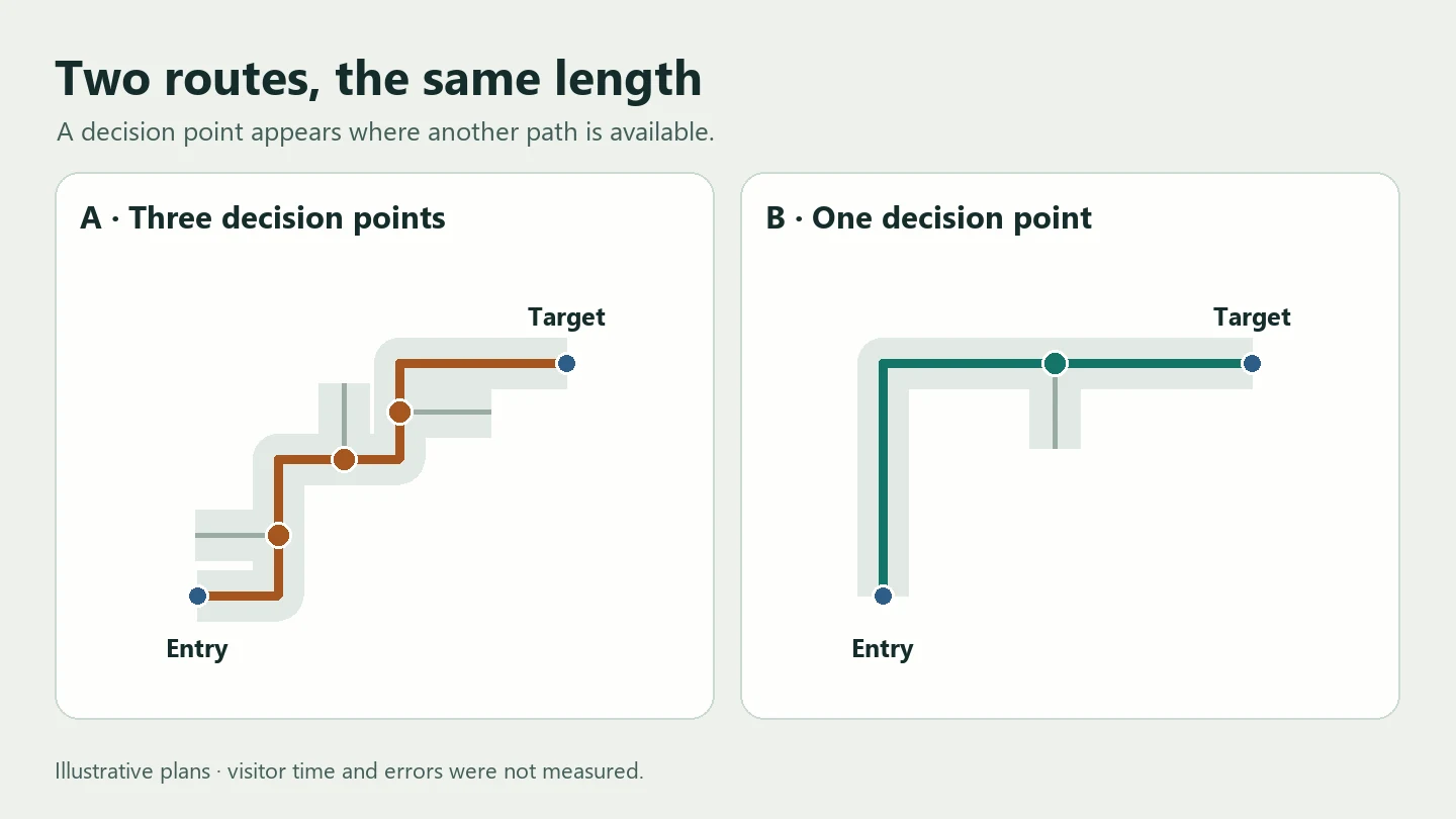
The two main lines have the same length on the diagram. Three and one are counts of branches. We did not measure people’s walking times or errors. In a real mall, the view matters too. An open atrium can provide a reference point, while a display that blocks a sign can make a short route harder to follow.
What studies in buildings and malls found
Michael O’Neill studied campus buildings with floor plans of different complexity under three conditions: no signage, textual signs and graphic signs. Signs helped, and layout complexity still influenced performance. When visitors get lost at the same junction, check the junction itself as well as the sign. A campus study does not establish the size of the effect in a particular mall. O’Neill’s study on signage and layout
Lu and Ye observed 31 participants searching for shops and pointing towards unseen destinations in a multi-level mall in Hong Kong. The centre had five atriums, providing views across levels for researchers to study. The participants were students, and the tests took place on weekday mornings. Consider those conditions when comparing the findings with a busy weekend or a different population. Hong Kong field study
In another multi-level building study, experienced participants favoured reaching the right floor before searching for the destination on that level. This gives a concrete question for a mall audit. Can visitors find the floor number and the relevant stair, lift or escalator before choosing a corridor? Study by Hölscher and colleagues
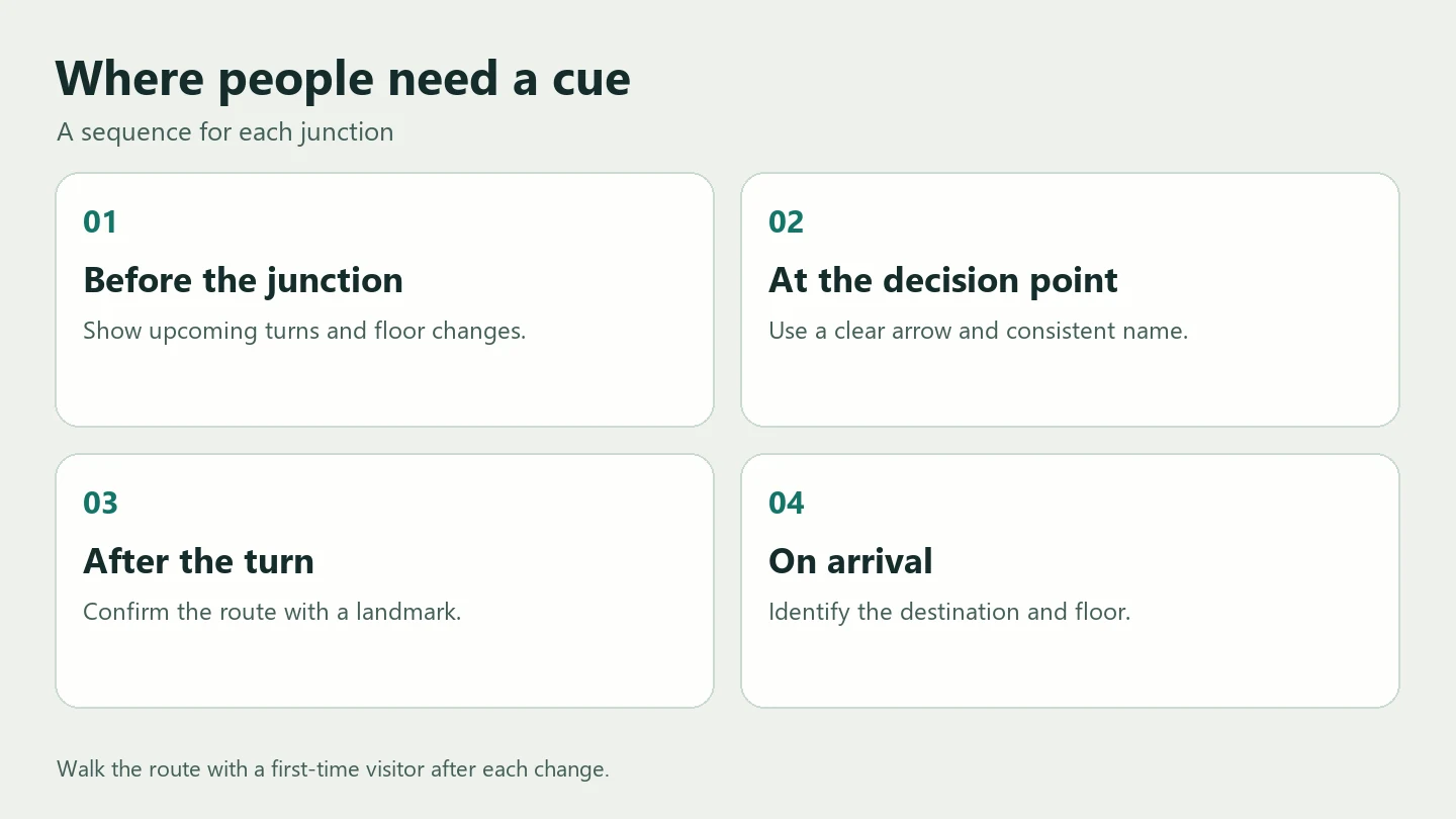
Information before, at and after the junction
| Moment | What the visitor needs | What to check |
|---|---|---|
| Before the junction | Do I need to change direction or floor? | Can I see the cue from the approach, while there is time to decide? |
| At the junction | Which direction should I choose? | Does the arrow have one clear meaning, and does the zone name match the map? |
| After turning | Am I on the right route? | Is there a confirmation sign or a recognisable landmark? |
| At the destination | Is this the right shop, exit or lift? | Can I identify the destination and level on arrival? |
For a “You are here” map, stand where people normally approach it and verify that the orientation is understandable. Keep entrance names, store names, parking zones and floor labels consistent across the website, app and on-site maps. Update them together when a tenancy changes. Practical wayfinding guidance
What visitors and operators can do
For visitors. Find the destination level and zone, then identify a suitable way of getting there. Remember the entrance name or car-park zone and a landmark nearby. If you lose your route, return to a point you recognise or ask at the information desk. Google Maps has indoor plans for some buildings. Check local access, opening and current information with the centre itself. Google Maps guide to indoor floor plans

For operators. Test three journeys: entry to information, entry to a destination on another level, and the return trip to a parked car. Check an accessible route that uses a lift. Include first-time visitors with different needs. Record time, wrong turns, help requests and points where key information was missing. Then move one sign or change one cue and repeat the observation under comparable conditions.
Check the whole route for accessibility, from the approach to the level change, information and destination. Pair colour with a name or symbol. Work with the relevant accessibility and safety specialists, and keep required signs visible when changing commercial wayfinding. In Ukraine, check the applicable edition of the building accessibility requirements for a specific project. Ukrainian accessibility requirements
How architecture and AI can help
An atrium, a ceiling treatment, light or a distinctive threshold can help identify a location. Connect that architectural cue to the wording on the map. If the directory says “Atrium A,” check whether the label is visible in the building. Walk the route from a first-time visitor’s viewpoint and record what distinguishes the atriums. Neuroarchitecture · Wayfinding through ceiling patterns
AI can group anonymised feedback or help edit a sign for clarity. Routes, accessible links and lift status need verified building data from the operator. After any change, walk the route before asking a new visitor to try it. Use the applicable specialist checks for accessibility and safety.
Frequently asked questions
Do more signs make navigation easier?
Information helps when it is visible, consistent and placed where people make a decision. If a sign is hidden or installed after the turn, review that location first.
Why can I see the floor I want without seeing a way to reach it?
An atrium gives a view across levels. The lifts, stairs or escalators can be elsewhere. Find the vertical connection as well as the destination on the floor plan.
How can I test wayfinding without special equipment?
Ask people to complete the same task. Note stops, wrong turns and requests for help. Change one detail and repeat the task. Include other routes and busier periods before drawing a conclusion about the whole building.
Related articles
AI in Architecture and Design: From a Room Photo to Plans and Quantities
Use AI to compare room designs, verify a measured floor plan and calculate paint and flooring. Includes four prompts and a worked room example.
CADCraft vs FreeCAD: Differences, Trade-offs and When AutoCAD Fits
Compare CADCraft, FreeCAD, AutoCAD and AutoCAD LT. Follow one plate from 2D drafting and DWG exchange to a parametric solid and animation.
CADCraft: Testing DXF and DWG With a Mounting Plate
A hands-on test of CADCraft 0.20.1. Draft a mounting plate, inspect the workspace and verify what survives DXF to DWG conversion.